Hyalite Canyon Soil Nail Wall
Client
US Forest Service
Location
Hyalite Canyon, Gallatin County, MT
Industry
Primary Service
Secondary Services
Earthwork Design and Inspection, Slope Stability, Landslide Stabilization, Lab Testing
Project Description
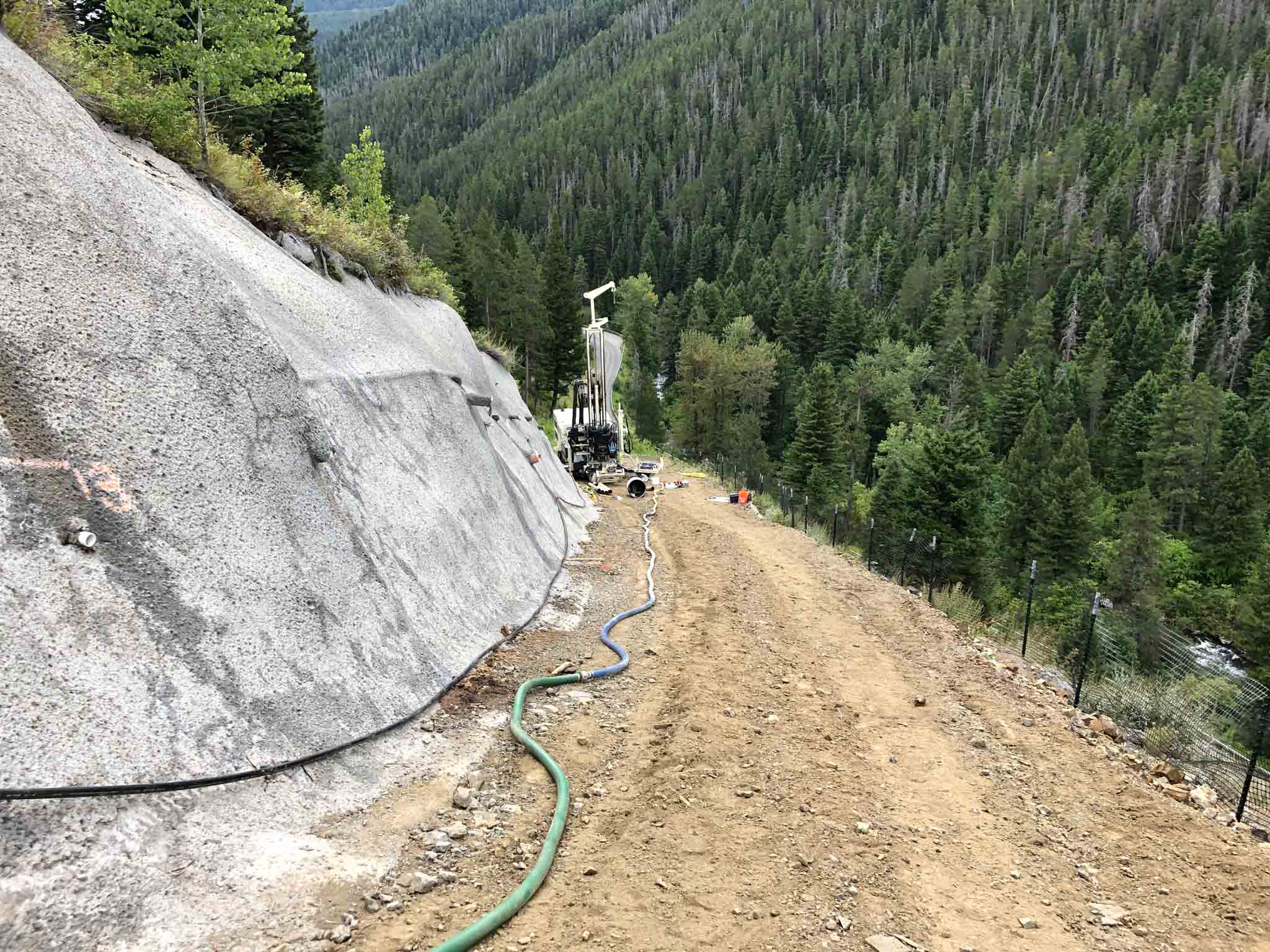
In 2010, a soil nail and shotcrete wall was constructed to stabilize a landslide in Hyalite Canyon. Since 2012, the USFS has actively monitored this wall for any movement. AESI was engaged to conduct annual slope inclinometer readings from two devices located on the bench in front of the wall. In 2018, AESI submitted a report analyzing ongoing issues at the slide, noting an acceleration in slope movement. To address this, AESI was tasked with laying out proposed horizontal drains, designing the access road, installing additional slope inclinometers and piezometers, and assisting with the selection and acquisition of remote monitoring equipment. AESI also monitored and surveyed the horizontal drains, developed AutoCAD Civil 3D soil horizon models using drone survey data and borehole logs, and back-calculated initial slope failure parameters using SLOPE/W. They then drafted a current-state SLOPE/W stability model with soil nail parameters estimated from third-party documentation.


Challenges
Monitoring & Data Collection: Continuously monitoring the soil nail and shotcrete wall for movement required precise and consistent data collection over several years.
Accelerating Slope Movement: The slope movement appeared to be accelerating, which posed a significant risk to the stability of the wall and surrounding area.
Design and Installation of Horizontal Drains: Designing and installing horizontal drains in challenging terrain required careful planning and execution.
Developing Accurate Models: Creating accurate soil horizon models and stability models required integrating various data sources, including drone surveys and borehole logs.
Coordination and Communication: Coordinating with multiple stakeholders, including the USFS and third-party documentation providers, was essential for the project’s success.
Solutions and Results
Monitoring & Data Collection: AESI conducted annual slope inclinometer readings and installed additional monitoring equipment, such as piezometers and remote monitoring devices, to gather accurate data. The implementation of slope inclinometers, piezometers, and remote monitoring equipment provided continuous and accurate data on slope movement. This allowed for timely interventions and adjustments as needed.
Enhanced Stability: AESI analyzed the data and proposed the installation of horizontal drains to manage groundwater and reduce slope movement. The installation of the soil nail and shotcrete wall, along with the horizontal drains, significantly improved the stability of the landslide area. This reduced the risk of further movement and potential damage.
Design and Installation of Horizontal Drains: AESI laid out the proposed drains, designed the access road, and monitored the installation process to ensure effectiveness.
Developing Accurate Models: AESI used AutoCAD Civil 3D and SLOPE/W software to develop detailed models and back-calculate initial slope failure parameters, ensuring a comprehensive understanding of the site conditions.
Coordination and Communication: AESI maintained clear communication and collaboration with all parties involved, ensuring that the project stayed on track and met all requirements.
Cost Savings: By using advanced modeling techniques and precise data analysis, AESI was able to design effective solutions that minimized unnecessary expenditures and optimized resource use.
