Milk River Floodplain Study
Client
MT DNRC
Location
Phillips County, Montana
Industry
Primary Service
Secondary Services
Floodplain Study, Hydraulic Modeling, Mapping
Project Description
AESI conducted hydraulic analysis and floodplain mapping for the Milk River and selected tributaries in Phillips County, Montana, as part of a comprehensive floodplain study led by MT DNRC in collaboration with FEMA and FEMA contractors. The study was designed to comply with federal and state standards and will serve as the foundation for the county’s Flood Insurance Study and updated Flood Insurance Rate Maps.
DNRC divided the project into 23 modeling domains, assigning AESI responsibility for Domains 8-14. Using 2D hydraulic modeling in HEC-RAS and floodplain mapping in ArcMap, AESI played a key role in advancing flood risk assessment methodologies. As one of the first firms in Montana to implement 2D floodway modeling, AESI’s analysis allowed for more precise mapping of complex flow patterns in flat and sinuous terrain, incorporating irrigation infrastructure and non-levee features that influence floodwater movement.


Challenges
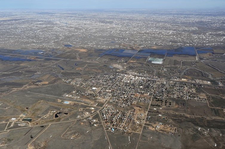
The study required detailed hydraulic modeling, particularly in Domain 11, which encompassed the town of Malta and demanded the highest level of precision in Phillips County. Additionally, the presence of Dodson Dam added complexity to flow modeling and flood risk assessment. Ice jam formation along the Milk River presented another challenge, requiring specialized analysis to account for seasonal flood risks.
Solutions and Results
AESI successfully completed one of the first 2D floodway modeling projects in Montana, enhancing the accuracy of flood risk assessment in the region. By leveraging advanced hydraulic modeling techniques, AESI provided a more detailed and realistic representation of flood behavior, improving floodplain delineations and risk mapping. These results will contribute to better-informed flood management decisions and updated regulatory tools for Phillips County.
