Sweet Grass County Ranch Property
Client
Private Owner
Location
Sweet Grass County, MT
Industry
Primary Service
Secondary Services
Topographic Survey, Drone Survey, Boundary Survey
Project Description
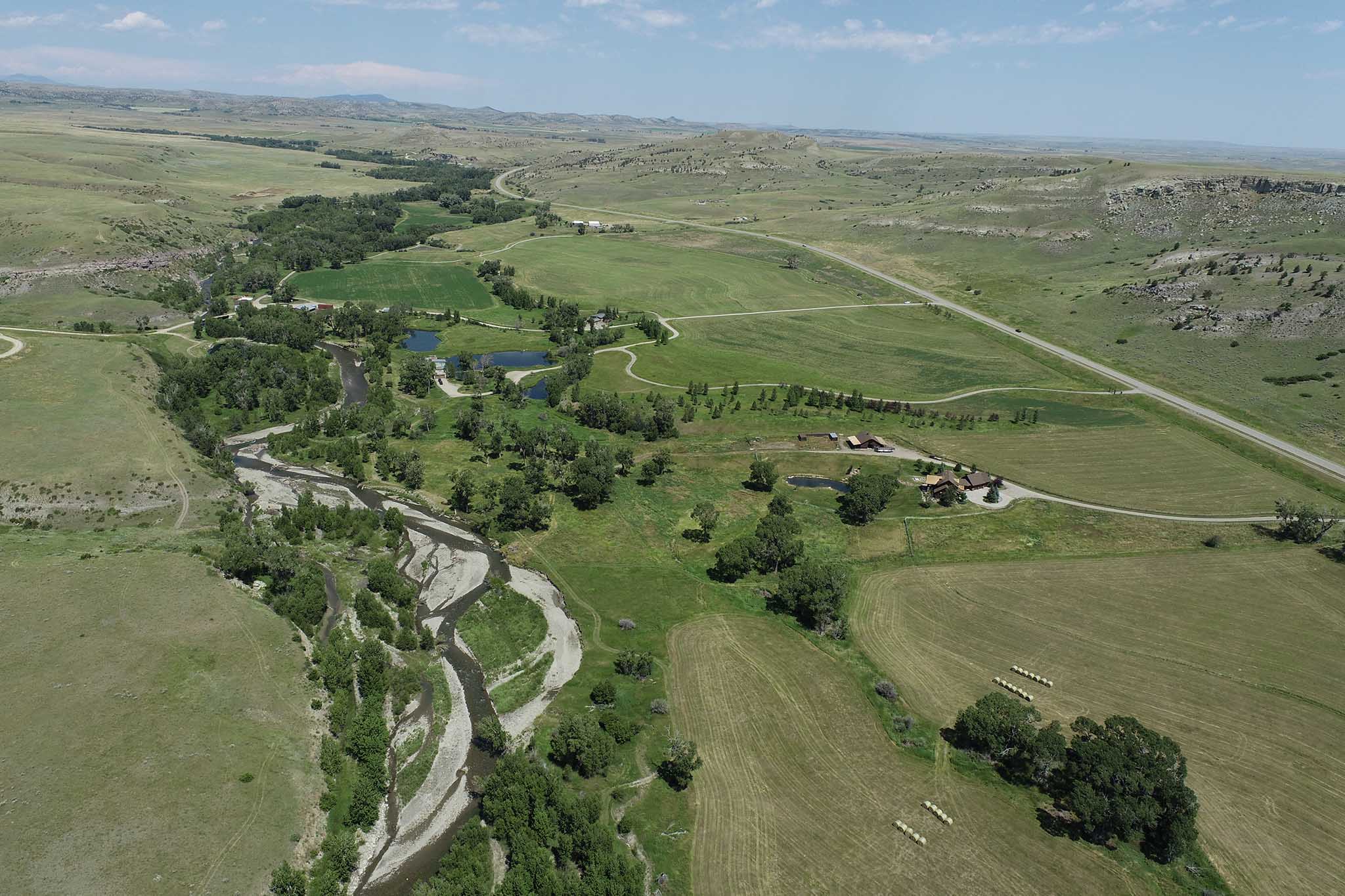
Allied Engineering Services, Inc. (AESI) developed a comprehensive basemap for a 1,200-acre ranch property in Sweet Grass County, MT. The basemap was designed to support master planning for building sites, structures, floodplain overlays, roads, and existing site conditions. Deliverables included AutoCAD files and PDFs tailored for use by the property owners, architects, and builders, along with a high-resolution orthophoto and detailed 1-foot contour intervals across the entire property. AESI also located and marked the property boundary on-site, providing the owner with clear, real-world visualization to support planning and development efforts.


Challenges
Large-Scale Drone Flights: Conducting drone flights over a 1,200-acre property required navigating strong winds and varying weather conditions, which posed challenges to flight stability and data capture quality.
Data-Heavy Post-Processing: The size of the property and the complexity of the terrain generated an extensive volume of data, requiring significant computational resources and meticulous post-processing to produce high-resolution orthophotos and accurate 1-foot contour intervals.
Boundary Marking in Varied Terrain: Locating and marking property boundaries across a large, diverse landscape demanded precise fieldwork and coordination to ensure accurate on-site visualization.
Integrating Multi-Disciplinary Data: Creating a basemap that accounted for master planning, floodplain overlays, roads, and existing site conditions required the seamless integration of civil, geotechnical, and water resource engineering data.
Time Sensitivity: Delivering comprehensive basemap files and visualizations to multiple stakeholders, including owners, architects, and builders, within tight project deadlines added logistical and operational pressure.
Solutions and Results
Optimized Drone Flight Execution: By conducting detailed flight planning that accounted for terrain and weather conditions, and implementing an aerial targeting plan with GPS precision, AESI successfully captured high-resolution imagery over 1,200 acres. This ensured the creation of an accurate orthophoto and 1-foot contour intervals despite challenging environmental factors.
Efficient Data Management and Processing: Leveraging advanced post-processing tools and workflows, AESI managed the substantial data volume generated by the drone flights, producing a comprehensive basemap and orthophoto with exceptional detail and accuracy for all stakeholders.
Accurate Boundary Visualization: Using GPS and specialized surveying equipment, AESI precisely located and marked property boundaries across the diverse terrain. This provided the owner with clear, real-world boundary visualization to guide future planning and development.
Seamless Integration of Complex Data: AESI combined civil, geotechnical, and water resource data into the basemap design, creating a versatile resource that included building site layouts, floodplain overlays, road alignments, and existing site conditions. This integrated approach facilitated comprehensive master planning for the property.
Timely and Comprehensive Deliverables: Through proactive communication and efficient workflows, AESI met project deadlines while maintaining high-quality outputs. Deliverables included detailed AutoCAD files, PDFs, orthophotos, and contour data, empowering the owners, architects, and builders to advance their planning and construction processes with confidence.
