Jefferson River Property
Client
Private Owner
Location
Three Forks, MT
Industry
Primary Service
Secondary Services
Boundary Survey
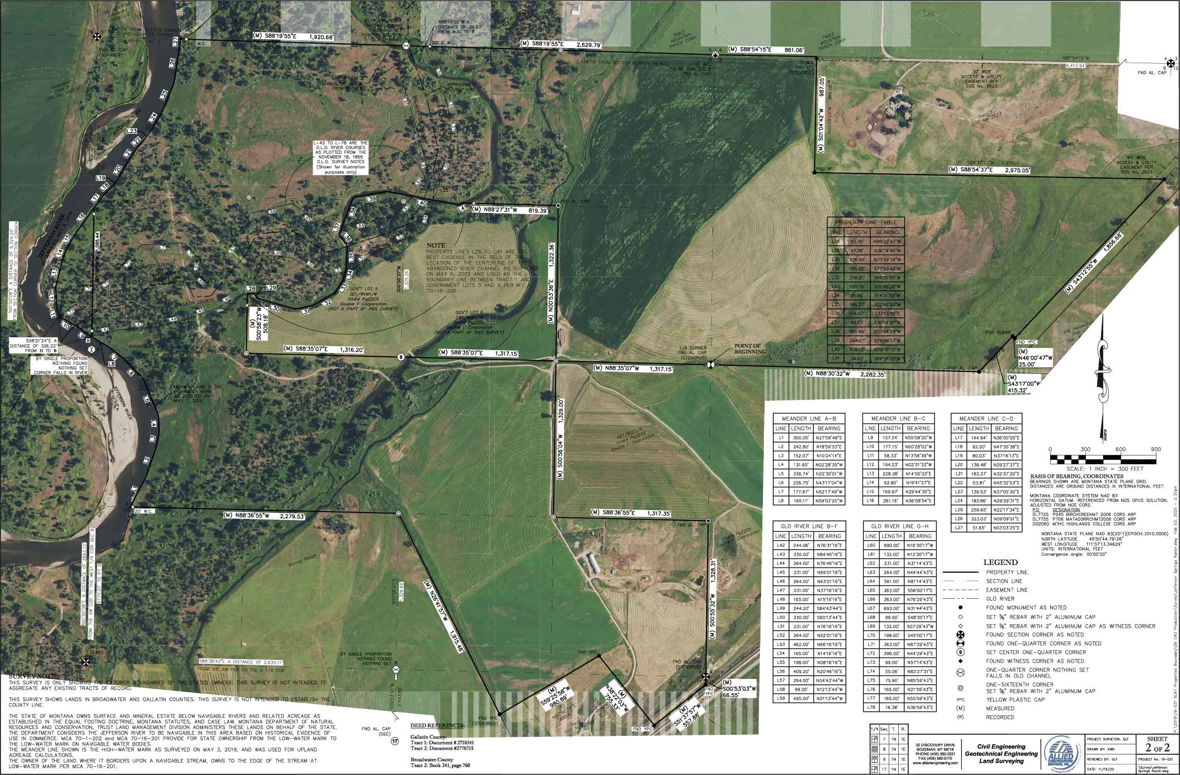
Project Description
Allied Engineering Services, Inc. (AESI) conducted a comprehensive boundary survey for a 634-acre ranch property located near the Jefferson River. The project included extensive research to identify and confirm the underlying tracts of record. AESI collaborated with the Montana Department of Natural Resources and Conservation (DNRC) and a third-party geomorphologist to investigate historic river channel migration and avulsion. By researching the underlying tracts of record and re-platting, AESI helped enhance the land’s value and utility, facilitating farm and ranch operations. Additionally, the team staked easement and property line locations, enabling the owner to visualize these critical boundaries on-site.


Challenges
Determining Accurate Boundaries: Extensive historical records and potential discrepancies in legal descriptions required careful research and verification.
River Channel Migration: Historical changes in the river channel and instances of avulsion complicated boundary identification and required specialized analysis.
Coordination with Agencies: Collaborating with the Montana DNRC and a third-party geomorphologist presented logistical and technical challenges.
Land Value Optimization: Identifying and re-platting underlying tracts to maximize operational efficiency and value required strategic planning.
On-Site Visualization of Boundaries: Ensuring property lines and easements were accurately staked for real-world visualization involved precise fieldwork and mapping.
Solutions and Results
Thorough Boundary Research: Conducted detailed investigations into tracts of record, resolving discrepancies and establishing clear, legally defensible boundaries.
Specialized Analysis of River Dynamics: Partnered with geomorphology experts and the DNRC to assess historical channel migration, enabling accurate boundary delineation despite natural changes.
Effective Collaboration: Communication and data-sharing with the DNRC and geomorphologist to integrate expert findings into the project seamlessly.
Re-Platting for Increased Value: Successfully re-platted underlying tracts, enhancing property value and operational functionality for farm and ranch use.
Accurate Boundary Staking: Precisely staked property lines and easements, giving the property owner clear, real-world insights into their land’s boundaries.
