United States Forest Service Park Lake Dam
Client
United States Forest Service (USFS)
Location
Helena National Forest
Industry
Primary Service
Secondary Services
Topographic Survey, LiDAR Drone Survey, Bathymetric Survey
Project Description
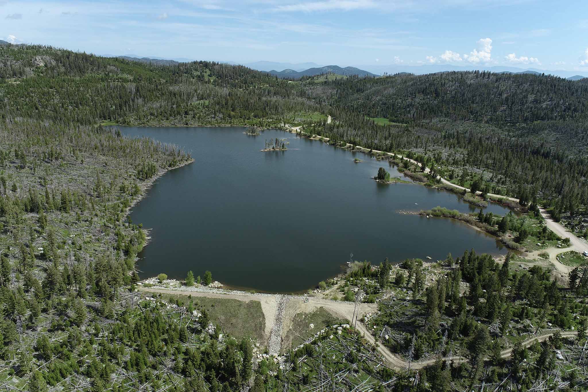
Allied Engineering Services, Inc. (AESI) conducted a comprehensive survey for the United States Forest Service (USFS) at Park Lake Dam in the Helena National Forest. The project involved creating a detailed basemap of the reservoir, embankment, and surrounding area using a combination of conventional GPS and Total Station methods, LiDAR drone technology, and sonar integrated with GPS. These methods were seamlessly combined to produce an accurate existing ground surface. Conventional survey techniques captured precise details of the dam embankment, LiDAR drone surveys mapped approximately 160 acres of surrounding topography, and sonar technology was used for lake bathymetry to map the lake bottom. The resulting surface model was utilized to develop stage-storage relationships, calculate lake volume, and support site grading efforts for the rehabilitation of the failing dam embankment.


Challenges
Integration of Diverse Survey Methods: Combining data from conventional GPS and Total Station methods, LiDAR drone surveys, and sonar bathymetry into a seamless and accurate surface model required careful alignment and advanced processing techniques.
Data-Intensive Analysis: The project generated a significant volume of data from multiple survey methods, necessitating robust computational resources and meticulous analysis to ensure precision in the final deliverables.
Detailing Complex Terrain: Capturing accurate details of the dam embankment, lake bottom, and surrounding topography presented unique challenges due to varied terrains and features requiring specialized survey techniques.
Environmental and Site Accessibility: Operating in a remote forested area with natural obstacles and potential weather-related disruptions made survey operations and equipment deployment more challenging.
High-Accuracy Requirements: The project’s critical purpose—supporting stage-storage analysis, lake volume calculations, and site grading for a failing dam—demanded an exceptionally high level of precision across all survey data and final surface models.
Solutions and Results
Effective Integration of Survey Techniques: AESI successfully combined data from conventional GPS and Total Station surveys, LiDAR drone mapping, and sonar bathymetry into a single, accurate surface model. This ensured a seamless representation of the dam embankment, lake bottom, and surrounding topography.
Advanced Data Processing: By implementing robust data processing workflows and leveraging high-capacity computational resources, AESI managed the large volume of data efficiently. This produced reliable and precise outputs necessary for the project’s success.
Accurate Mapping Across Varied Terrain: AESI utilized conventional survey methods for capturing fine details of the dam embankment, LiDAR technology to map the expansive 160-acre area, and sonar to provide a complete picture of the lake bottom. This comprehensive approach resulted in a detailed and accurate representation of all critical project features.
Adapting to Remote and Challenging Conditions: Despite the remote forested location and natural obstacles, AESI adapted equipment deployment and workflows to complete the surveys effectively. This ensured the project was delivered on time without compromising accuracy or quality.
Delivering a Comprehensive Ground Surface for Analysis: The final surface model, which incorporated all surveyed elements, supported detailed stage-storage analysis, lake volume calculations, and site grading for the failing dam. This comprehensive deliverable was instrumental in facilitating the rehabilitation planning for Park Lake Dam.
